Image credit: Redhawk Land Surveying
Land surveying is a crucial first step before any residential, commercial, or industrial project begins. It is used to create a map of the complete layout and boundaries of your chosen land and includes various field work, research, and measurement aspects. A land survey will map out accurate dimensions and drawings of your land parcel, clearly defining any natural or man-made features to capture the full topographic scope. This is the responsibility of boundary and land surveyors, and they work with specialized equipment like theodolites and laser levels as well as software tools like AutoCAD to precisely identify all the boundary lines. Various measurement techniques and sciences are applied to locate the land’s physical monuments while referring to the historical records of the property. This reveals key facts about property easements, possible encroachments, land development recommendations, and applicable codes for your construction crew to follow.
Once the boundaries are identified, your land surveyors will mark those limits to officially define the piece of land that you now own, so this has everything to do with protecting your property rights. There are several ways to survey a land parcel, each designed to address different features to represent. In this article, we will focus on two types of land surveys – the ALTA survey and the boundary survey – and explore their importance and applications in construction projects.
ALTA survey
What it means
An ALTA land title survey is a type of land survey required for commercial and multi-family real estate projects. It provides a detailed analysis of a property and is a very comprehensive survey based on the requirements presented by the American Land Title Association (ALTA) and the National Society for Professional Surveyors (NSPS). For this reason, such a land survey is also referred to as the ALTA/NSPS survey, and it is more suitable for commercial needs because of the complex details and specifications it covers. Both organizations add a degree of trust and guarantee that the results of ALTA land surveys are accurate, detailed, complete, and professionally formatted before they reach their audiences – who are typically buyers, sellers, and insurers looking for all this information about the property.
An ALTA survey is considered to be the best, standardized survey for all states because it meets the top standards that are acknowledged and verified throughout the US. It is one of the main real estate documents to be discussed during transactions as well as for potential legal disputes in the future. Since ALTA land surveyors need to check various historical records of the land and rely on advanced equipment to meet these strict standards, you can expect an ALTA survey to cost a lot more than a boundary survey.
What it includes
An ALTA survey includes everything covered by a boundary survey plus several other considerations, so it is more complicated and detail-oriented than a simple boundary survey (as we will see below). Here are the property details you will find in an ALTA survey (which also represent the requirements of what should be included according to the ALTA and the NSPS):
- Boundaries
- Mortgage survey
- Commercial building location
- Building access points
- Right of way limits
- Easements
- Encroachments by other properties
- Roads
- Land improvements/developments
- Zoning
- Monuments and other physical features
- All additions/removals in the parcel’s history
- Water bodies on the boundaries
- Property risks
- Flood zone classification
- Utilities
These are the main property elements to include in ALTA surveys, which takes considerable time, effort, and money. Once an ALTA survey is complete, it clearly defines your property boundaries, confirms your legal ownership of the parcel, and lets you know exactly where one parcel ends and the other begins.
Who needs it
ALTA surveys are needed and used by different audiences. Banks, lenders, attorneys, plot owners, and title companies require ALTA surveys to be issued for clarifying all survey matters associated with a property. Title insurers need an ALTA survey to find out applicable exceptions to policies, whereas buyers and sellers need it for evaluating the risks connected to their properties. Since ALTA surveys are primarily used in the commercial sector because of their high level of detail, anyone aiming to buy or sell commercial parcels must request an ALTA survey for the same.
Property owners can receive proper financing for projects backed by ALTA surveys, and they can also secure title insurance more easily because ALTA standards help streamline the whole legal process with full transparency and credibility. Most of the time, an ALTA survey is needed by anyone trying to sell their commercial properties or buy insurance policies. If ALTA standards get revised by the authorities (which happens eventually to refresh the rules) and it has been too long since your last land survey, then you will need a new ALTA survey regardless of your commercial standpoint.
Why it is important
Apart from officially defining your land’s boundaries and facilitating commercial property transactions, ALTA surveys have a huge legal responsibility to fulfill. When it comes to commercial properties, title insurance is needed to protect both the owner and lender against any possible disputes and claims associated with the property’s history. This keeps you safe from the impact of various liens against the property – filed by someone in the past against the owner during that time. Without title insurance, you could be sued for money owed to a legitimate audience still waiting for their dues to be cleared. By getting your title insurance, you can protect yourself from all such liabilities and claims attached to your property and avoid lawsuits – or even financial setbacks.
This is where an ALTA land title survey is absolutely crucial, as it begins right at the boundaries that determine your legal ownership of the commercial property. Using the standards proposed by the ALTA and the NSPS, you can ensure a survey-driven insurance policy and be able to overcome financial exceptions placed on your property – which means that your insurance will now cover any financial losses arising from property and boundary disputes. ALTA surveys play a huge role in designing well-curated insurance policies that give you maximum coverage, and this is what makes them critical for commercial real estate transactions. They also confirm and clarify that your property’s title is only liable to the issues presented by the ALTA survey map – anything outside of this simply falls out of scope and cannot hold you accountable.
How it is done
ALTA surveys are conducted through deep field research and investigation with the help of ALTA land surveyors. These experts use specialized tools to gather relevant field data and build a comprehensive map to represent your chosen land. The entire process should conform to the proposed ALTA standards, and here is how it generally unfolds:
- Reviewing historical data. Your ALTA land surveyors will begin by going through various historical documents and records of your property – typically by reaching out to your local government departments for papers and digital copies. This will help them unearth key facts and data connected to your land (such as its boundary identifiers). In some cases, such historical records might be very old and difficult to find within the current archives – they might as well be non-existent if they were never digitized. By digging into all the available property records, your surveyors can re-establish the original boundaries and other details since the parcel’s inception.
- Identifying physical markers. The next step is to locate and identify physical markers or monuments that define your property’s corner points and boundaries (usually with the help of surveyor-branded pins that are drilled into the ground). These markers could have been left by the government or previous surveyors, so they can be both old and new identifiers of your property. From the results of Step 1, your surveyors will also find out if any visually identifiable objects (accessories) were used to mark corners in the past. These could be trees and rocks or any artificial landmarks like statues that act as visual shoutouts to the property’s lines.
- Installing reference monuments. If it is not possible to locate a clear property corner, your land surveyors will install reference monuments to roughly mark where the corner should be.
- Creating a map/plat. Once all the previous records and markers are identified – and new land references are installed – your surveyors will successfully finalize your property’s limits. Using this updated information, they will create a property map with CAD tools and ALTA standards to capture boundaries, topographic features, disputed lines, easements, rights of way, and other details. This essentially marks your proposed site for construction activities. The surveyors will also include their contact details, signatures, and licenses to make it clear who worked on this map for future reference. You will then have a completed ALTA survey ready to use, titled the “ALTA/NSPS Land Title Survey”.

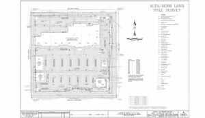
An ALTA survey by ALTA Southwest
Boundary survey
What it means
A boundary survey, in contrast, is much simpler and more straightforward than an ALTA survey, required before you purchase, improve, or build on a land. It is a very common type of land survey designed to help individuals find out where exactly their property is located and how far it extends. This survey defines the perimeter of a property based on the analysis of a land surveyor, who is responsible for evaluating the land and identifying its boundary. The focus is on two main goals: finding boundaries and identifying anything that crosses them. Boundary surveys are key preconstruction requirements because they mark the actual, physical limits of your construction site – indicating where exactly the work can be done in order to avoid future disputes on the land. They also retrace and re-establish any previous boundary lines and corners in case someone else marked these out earlier on the parcel.
All the findings and evidence from the survey are displayed on a map to fully represent and describe the surveyed parcel. Boundary surveys also locate easements and encroachments on a property. Since there are no complex details involved – unlike ALTA surveys – you will mostly use a boundary survey for residential projects, though they can be used for commercial considerations as well.
What it includes
A boundary survey zooms in on the following features:
- Lot dimensions
- Location of property corners
- Boundary lines between two plots
- Plot improvements (such as garage or pool additions from previous owners)
- Location of other structures near the lines
- Easements (such as utility lines crossing between two plots)
- Possible encroachments due to driveways, fences, landscaping, etc.
- Property descriptions (address, square footage, deed information, parcel numbers, etc.)
- Fence lines (which may differ from the actual property lines)
- Local restrictions on the property
Since boundary surveys are not as elaborate as ALTA surveys, they do not cost as much and can be completed sooner. An ALTA survey will include all of the above features in addition to several more to build a complete and comprehensive perspective of the property.
Who needs it
Boundary surveys can be required and used by different residential and commercial audiences. Lenders and title companies need boundary surveys to verify legal property lines before making any transaction. The limited details and features of a boundary survey are enough for property owners to get all the information they need about the property. However, if insurance companies or buyers require more details – such as flood zones – they should refer to an ALTA survey instead.
Why it is important
A boundary survey must be conducted before improving or building on a piece of land. This ensures that all construction activities take place within the right boundaries and do not cross any neighboring lines. Boundary surveys are common surveys for various construction and improvement projects because they give the green light to all the legal modifications you can make on your property. They tell you about the right placements for each improvement and clearly highlight encroachment areas to help you avoid them.
At the same time, they reveal any structures or landmarks such as driveways, landscaping, and other houses that could be crossing your boundaries. If this is the case, your surveyors can use this opportunity to work out solutions in your favor by proposing easement possibilities or revisions with relevant agencies. With the help of a boundary survey, you can identify and prevent various disputes regarding the legal limits of your property. This includes simple but key considerations like installing your fences near or on the boundaries to accurately mark your property limits.
How it is done
Land surveyors conduct boundary surveys to mark property lines and corners and create an accurate map. The following steps are usually involved in this process:
- Reviewing property records. Land surveyors begin the survey with thorough research of the property’s public records, maps, plats, and deeds to extract information and evidence. This includes reviewing any adjoining property records for a complete analysis. They will review each document to gather facts and considerations like previous measurements and identifiers left by other surveyors. This will help them create a rough sketch of the boundary lines using preliminary findings, and they can have all the initial calculations to use during the actual survey.
- Conducting field survey. Using the data collected from the property’s historical records, your land surveyors will explore and evaluate the property and take their own boundary measurements. This step includes locating and identifying physical monuments, corners, fences, and other features that can be used to compare with the preliminary findings so that your surveyors can zoom in on accurate boundaries through visual verification. Field surveys also include identifying potential encroachments and noting down property improvements made so far.
- Setting visible monuments. Once the final boundaries are confirmed, your surveyors will install identifier pins or surveyor pins to mark each corner. This step focuses on both setting new markers and restoring old ones using different monuments like iron rods, rebars, nails, flags, or concrete slabs. Restoring old markers allows surveyors to actually re-establish verified and legal corners that might have gone missing or blurred out over time. It is important to set easily visible markers that can be located from a distance, so your surveyors can use different techniques like installing vertical posts or applying bright paints to make sure that each corner stands out.
- Creating a map. Finally, an official map will be created to represent the outcome of your boundary survey in accordance with your state laws. Such a map includes clearly defined property lines and encroachment details to let you know your property limits before any construction/improvement begins.

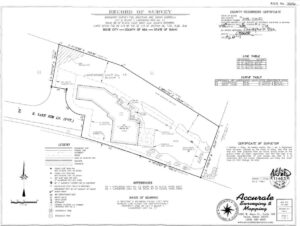
A boundary survey by Accurate Surveying and Mapping
ALTA survey vs boundary survey – a summary of differences
Here are the key differences between an ALTA survey and a boundary survey:
- An ALTA survey offers more details in addition to boundaries, such as improvements, easements, associated risks, flood zones, access points, rights of way, zoning, etc. A boundary survey only focuses on the actual boundaries between two plots as well as possible encroachments on them.
- ALTA surveys are generally more precise because they need to adhere to the ALTA and NSPS standards (which are recognized nationwide). They are considered the highest surveying standard also because extensive background research and advanced technologies are required to drive the process. Boundary surveys have a much lower burden and precision level in comparison.
- ALTA surveys are primarily used by commercial clients for larger commercial transactions because of the heavy-duty features and findings present in an ALTA survey – which help with insurance and legal standpoints, including risk assessments. Boundary surveys can be used for both residential and commercial purposes as they make a key prerequisite for both construction types.
- Since ALTA surveys need more details and precision, they can be very time-consuming and expensive to conduct – often costing an average of $2,000 and lasting several months. Boundary surveys tend to cost a minimum of $500 and can be completed in a couple of weeks – or even 10 days for urgent cases that cost more.
Adjusting your GPS pin
ALTA surveys and boundary surveys are two of the most commonly requested survey options depending on the level of detail you require. They help various residential and commercial audiences avoid the risk of lawsuits, divided ownership, property conflicts, and violations by using verifiable, survey-backed evidence. Make sure that you hire reliable land surveyors who specialize in the right type of surveys for your project and have updated skills to match the latest standards. Survey rules, standards, practices, and property laws keep changing, so if things have been suspiciously quiet for a while, remember to get your property surveyed in time, and update your GPS pin accordingly!
